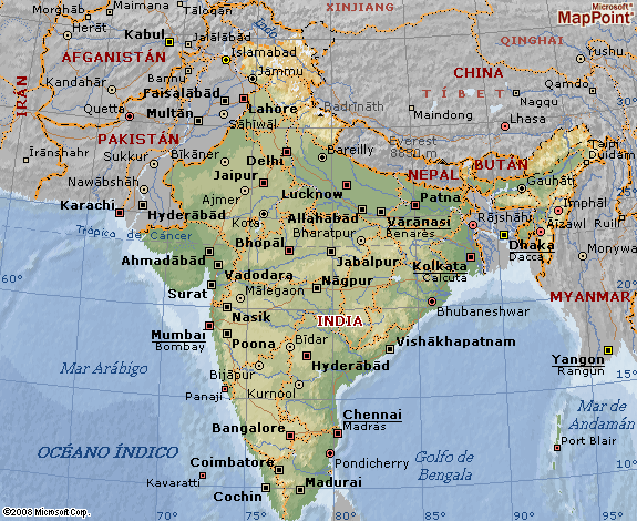
Today we are going to talk about the geography and climate of India. India has most of the Indian subcontinent. It is bounded by the Indian Ocean in the south, the Arabian Sea in the south-west, and the Bay of Bengal in the southeast of the country.
It is worth noting that it shares land borders with Pakistan to the west; with China, Nepal and Bhutan to the northeast, and Burma and Bangladesh to the east.
La coast of india it measures 7.517 kilometers in length. The continental coastline is made up of 43% sandy beaches, 11% rocky shores, including cliffs, and 46% marshes or marshy banks.
The rivers of india they originate mainly in the Himalayas. Among the most important rivers in the nation we find the Ganges and the Brahmaputra, which flow into the Gulf of Bengal.
Among the important tributaries of the Ganges River we find the Yamuna and the Kosi.
As to indian climate, we can say that it is strongly influenced by the Himalayas and the Thar desert.
The Thar Desert plays a crucial role in attracting the monsoon winds between June and October, which provides most of India's rainfall.
The climate of India depends on the geographical area in which we are located. Thus we find various types of climates such as the humid tropical, the dry tropical, the humid subtropical and the montane.
Photos: Voyages Photo Manu