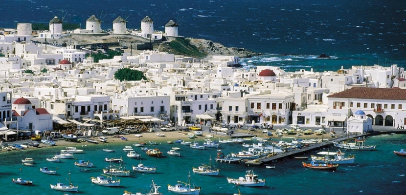
Greece It is located at the southern tip of the Balkan Peninsula. It has an area of 131.957 square kilometers, and its coasts measure approximately 15.000 km.
Its territory comprises three geographical units, mainland Greece, the peninsula of the Peloponnesus, and the islands that represent a fifth of the total surface of the country. The Greek coasts are bordered to the west by the Ionian Sea and to the east by the Mar Aegean, where most of the Greek islands are located. The only islands in the Aegean that are not Greek are Imbros and Tenedos. The number of islands in Greece it varies according to the definition chosen.
In the 2001 census, 169 islands were inhabited, but a third of them had fewer than 50 inhabitants. The size of these inhabited islands ranges from 3 square kilometers to Of the, at 8.263 square kilometers for Crete.
No point of Greece It is far from the sea, in the Peloponnese and central Greece, it is only 50 km away. In fact, there are no mountains in Greece from which the sea cannot be perceived.
Greece It is located at the meeting of the African and Eurasian tectonic plates. During the Mesozoic, was covered by the Tethys ocean of which the Mediterranean is a vestige. The approach between the plates created the alpine movement of which the mountains of Greece are a part. This movement led to the fracture of the Eurasian plate creating the Aegean Sea plate.
It also created immense layers by making western Greece it is formed of calcarium and the east of crystalline and metamorphic massifs. The tectonic movement continues and for this reason there are frequent earthquakes. Half of the annual earthquakes that occur in Europe take place in Greece.
At the beginning of the 1830s, the first STATUS independent Greek of the modern era is born, after a war of independence against the Empire Ottoman.