
Morocco, in northwestern Africa, is the gateway to the African continent for many Europeans, since its natural beauty and the spectacular nature of some of its cities and villages have become a point of reference for world tourism.
In this article we will talk about the geography of Morocco, especially its orography with the main rivers and mountains that populate this incredible region of the African coast.
Geographically Morocco has four mountain ranges:
- the Rif,
- the Middle Atlas,
- the Grand Atlas and
- the Antiatlas.
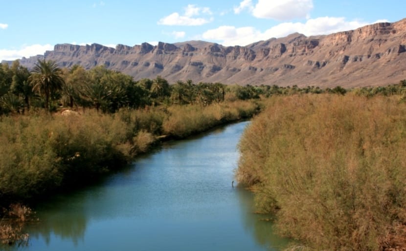
Its highest mountain is Toubkal, with more than 4.000 meters of altitude. Between the Rif and the Middle Atlas is the Sebu Valley, one of the most fertile valleys in Morocco and one of the centers of agricultural production in the region.
The main rivers are: Sebu, Muluya, Oum Er-Rbia, Tensift, Sus and Draa.
Little by little I will reveal to you some secrets and wonders of the mountains and rivers of Morocco.
The Rif
It is a region in which mountains and green areas are combined, with a coastline on the Mediterranean. Traditionally it has been an isolated and disadvantaged area. Its inhabitants are Berbers or Amaziges, and Arabs, in fact many Europeans When Europeans visit the Rif, they are surprised by the physical appearance of its inhabitants, because a large proportion of them have a European appearance, individuals with light skin, blue eyes , gray or green and blonde or red hair. Administratively, it comprises six Moroccan provinces: Alhuceima, Nador, Uchda, Driouch, Berkane and Taza and the autonomous Spanish city of Melilla.
This mountain range is not excessively high, its maximum altitudes barely exceed 2.000 metersIts highest summit is Tidirhin, which is 2.452 meters high and is in the Retama region.
Curiously the beaches of the Rif coast, at the foot of the mountains, are the best in Morocco, which makes them an important tourist attraction.
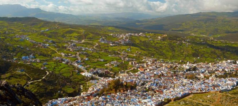
The Middle Atlas
This area is known as the Switzerland of Morocco since in its mountain range there are some small medium-altitude cities, typically Berber in appearance.. The Middle Atlas is 18% of the mountainous terrain of Morocco, stretching for 350 km, between the Rif and the High Atlas. Its extension occupies the provinces of Khénifra, Ifrane, Boulmane, Sefrou, El Hajeb, and part of the provinces of Taza and Beni Mellal.
In the Middle Atlas you can find the Tazekka National Park, with landscapes of gorges and caves and the Ifrane National Park, well known for its unique butterflies, and the Tazekka park.
Its highest mountains are the Jebel Bou Naceur at 3.356 meters, then the Jebel Mouâsker at 3.277 meters, and the Jebel Bou Iblane at 3.192 meters, near Immouzer Marmoucha.
The main rivers of Morocco are born in its mountains, which I will tell you about in a later section.
The great atlas
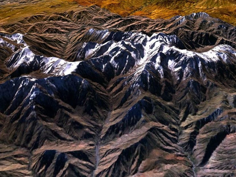
The Great Atlas, or High Atlas has the highest altitudes in all of North Africa, with the highest point on Mount Toubkal (4.167 meters). This impressive sub-mountain range is a meteorological barrier of Morocco, it separates the coasts of the Mediterranean Sea and the Atlantic Ocean from the Sahara desert and, in fact, it is one of the factors that cause the dryness of this desert, which in turn causes drastic changes temperature throughout the mountain range. In the highest areas of the mountains the snow falls regularly, allowing you to practice winter sports until well into spring.
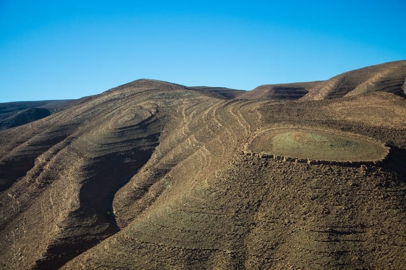
The Antiatlas or Little Atlas
The Antiatlas also known as Little Atlas It extends in Morocco, from the Atlantic Ocean in the southwest, to the northeast, at the height of Ouarzazate and further east to the city of Tafilalt. In the south, it reaches the borders of the Sahara.
The highest summit is 2.712 meters high is the Amalou n'Mansour, located in the southeast of the city of Iknioun, in the El Jbel Saghro or Jebel Saghro massif.
Open to the hot and dry winds of the Sahara, The Antiatlas still preserves valleys and authentic oases that are quite well irrigated and cultivated, such as that of Tafraoute, which cause an important contrast with the steppe and arid landscape of the most exposed slopes.
The hydrography of Morocco
The most important and mighty rivers of Morocco flow into both the Mediterranean and the Atlantic slopes, and are:
- draa
- Their
- tensift,
- Oum Er-Rbia,
- Moulouya
- Sebu
The Sebu River in northern Morocco flows to Fez and then west to the Atlantic Ocean. It has a length of 458 kilometers and its waters make its basin rich for cultivation of olives, rice, wheat, beets and grapes, which makes it one of the most fertile regions of the country. Its most important tributaries are the Uarga, Baht and Inauen.
The Muluya River, another important one, has the largest hydrographic basin in Morocco and the non-Saharan rivers of North Africa. It empties into the Mediterranean, very close to Algeria. The Chafarinas Islands face the delta-shaped mouth of this river, about four miles away. The area of the mouth and its set of marshlands are a very important enclave of biological interest, included in the international Ramsar list of wetlands.
The name of the river Oum Er-Rbia means mother of spring, it is the second river in Morocco by length. Its abundant flow has led to the construction of a series of dams, up to eight, which has made it the cornerstone of Morocco's hydroelectric and irrigation network, although it is not yet self-sufficient.
The Tensift River originates in the High Atlas and empties into the Atlantic Ocean, between Safi and Essaouira. Although it receives numerous tributaries, its flow is very irregular, it is almost dry in summer.
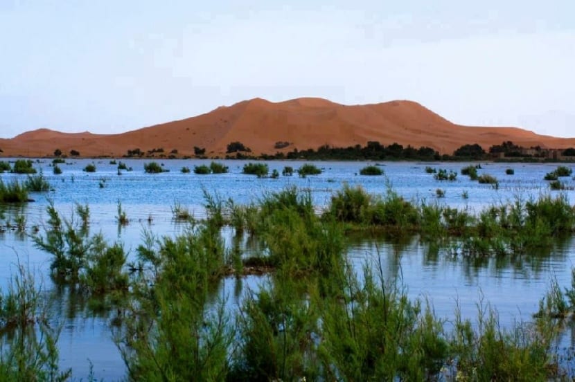
The Draa is the longest river in Morocco and Algeria, measuring about 1.100 kilometers. It is born in the High Atlas and empties into the Atlantic Ocean. It is a river with a very peculiar flow or route, because the climatic conditions for thousands of years have altered its course, so that at present its waters are filtered in the sands of the desert past Mhamid and continue their course in a way underground, heading for more than 600 kilometers towards the Atlantic. Only in exceptional years of rain does it return to its old bed.
Finally, I will tell you about the Sus River that runs through a depression in the Souss-Massa-Draa region, to which it gives its name, and empties into the Atlantic Ocean. The most important thing about this river is the biological richness of its mouth.